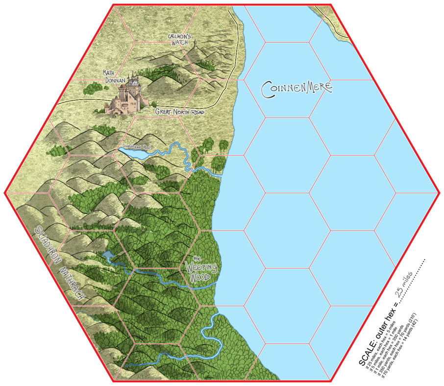
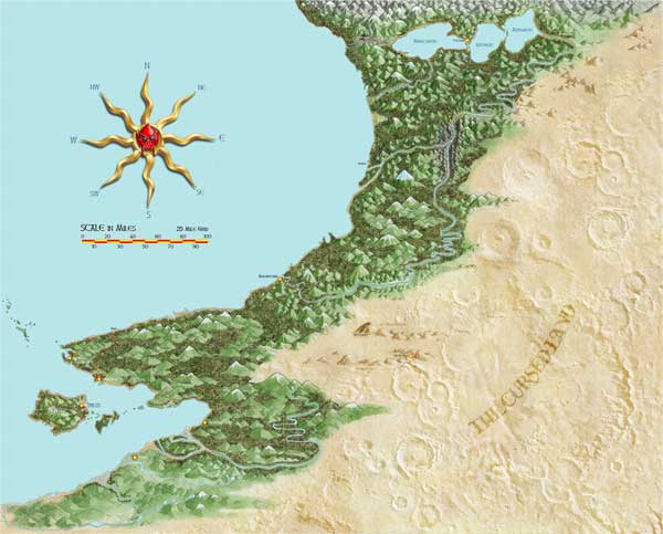
 Rath Donnan - environs (25-mile hex)
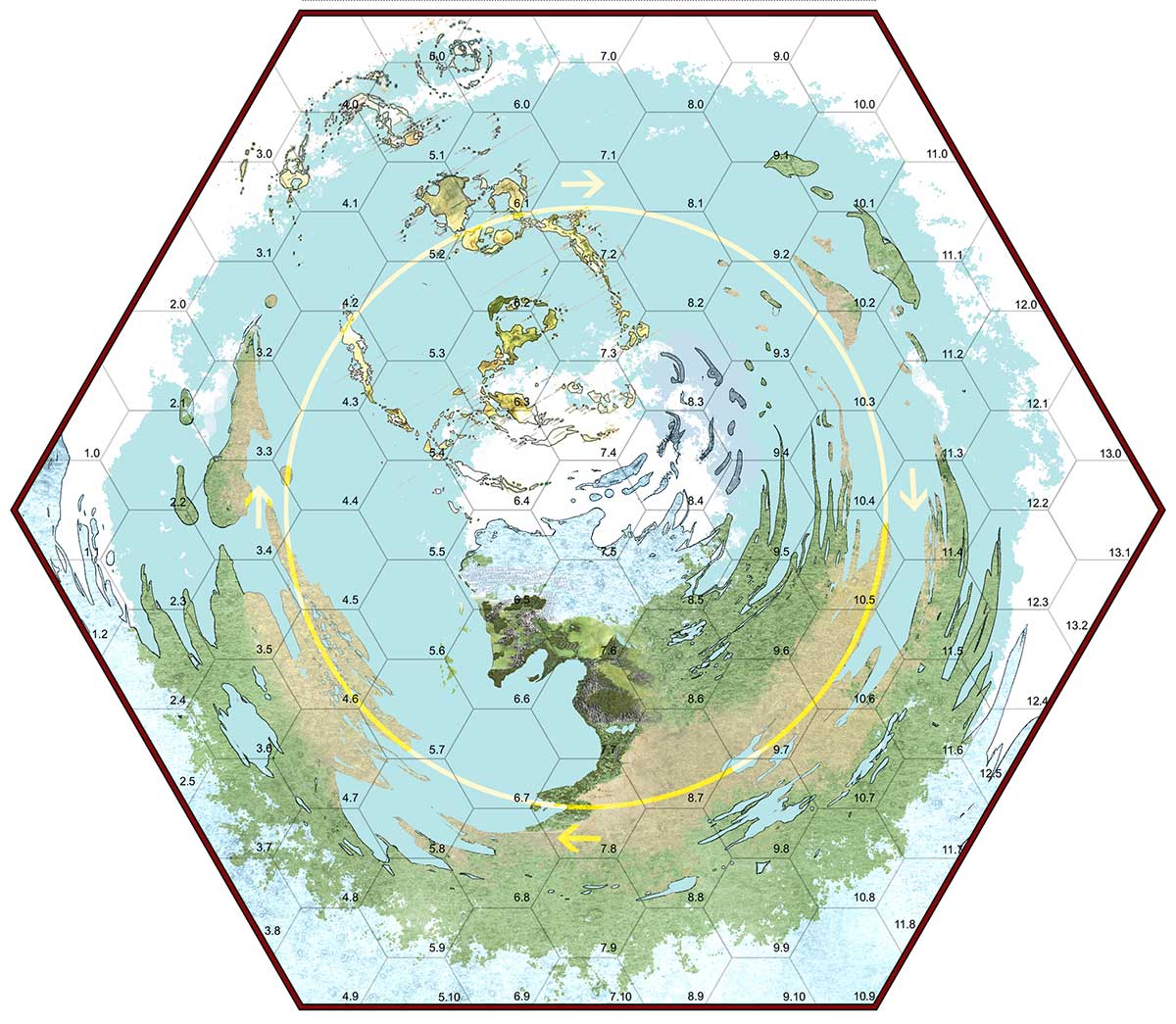
NOTE: It's likely that unless you have a much higher-resolution display than mine, the image is shrunk. If you right-click on it and select "Open image in a new tab" you can see it at full size.
This map shows the relationship of the land-forms shown in the maps below; they've been overlaid on the basic map. There is minimal geopolitical detail shown. Each hex is 1,000 miles across, from side to side.
The yellow circle shows the path of the sun and moon — they are on opposite sides of that circumference.
"North" is the centre of the plane, "South" is the perimeter, so it is not necessarily a constant direction from two different places on the plane.
It's important to bear in mind that this world IS NOT A SPHERE. It's a flat(tish) plane.
This is just one of about twenty or thirty adjoining planes on the surface of a multi-planar sphere. If you imagine a d20 or d30, this would be one face of the die. With the proper protection and life-support, it is possible to walk from one "face" to another (though border conditions are inimicable, to say the least), and the planes also interconnect via the UnderDark.
The fact that two planes are adjacent and border one another is no guarantee that they have similar life-support requirements.
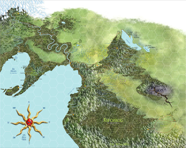
(JPG, approximately 670 KB). This is a work in progress; there are still a bunch of place names to be filled in, though the main geographical features are pretty much complete.
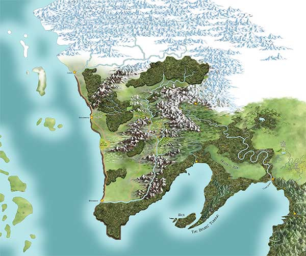
This is where I've merged Færûn's Sword Coast (Neverwinter and Waterdeep, et. al.) with my own world.
JPG file, 2086 x 1661 px, approx. 971 KB
Rath Donnan - environs (25-mile hex)
JPG file, 2072 x 1667 px, approx. 796 KB
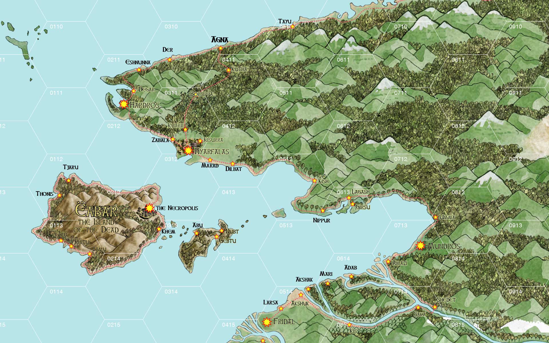
Hyarfalas and the Southern Empire, including the Isle of the Dead
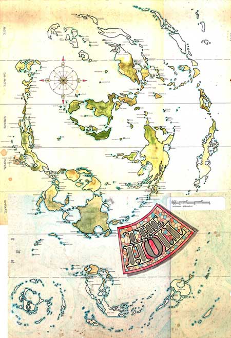
This great archipelago encompasses all of one hemisphere, from pole to pole. I haven't yet got around to prettifying this map, which is sadly faded from its glory days.